
 |
| A chilly April day, more snow falling in the Eastern Sierras |
It still is an unusually cold year, late April and it feels like mid-winter (Southern California midwinter, though). In fact, my first mountain bike trip, Erin Carroll's Tour de Los Padres was pushed to the end of April because of all the snow. So it is yet to come.
Instead, I first head off for another motorcycle trip on the new CA BDR (backcountry discovery route). The CA BDR route was released January 2019 and I got the map as soon as it was printed. I did the first 5 sections in February on a 1000 mile loop: CA Backcountry Route. Now I want to do the remaining part of the route, which is from Death Valley to Benton, mostly along the Eastern Sierra.
Death Valley itself is now getting hot, temperatures between 35 and 40 degree celsius. Not unbearable yet, that will happen soon, but hot. Later than usual because I have been to Death Valley 3 times already this year (in January, February, and March) and was cold there every time (and got rained on)!
Forecast was for pleasant temperatures, but sure enough, I got rained on (and only because I wasn't at altitude yet)

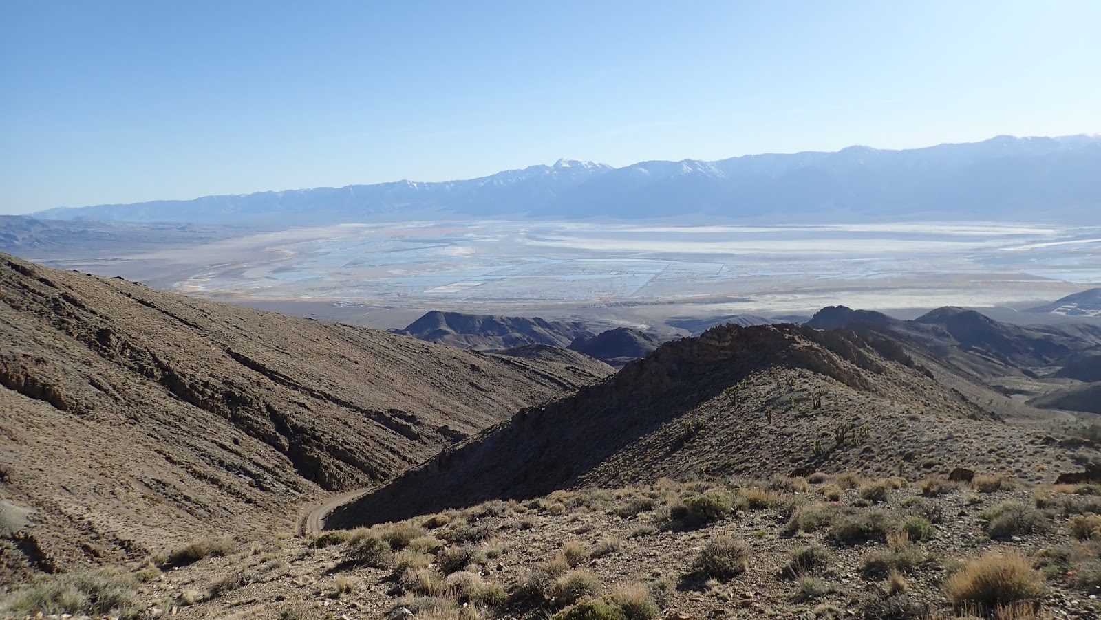
Section 7 of BDR: Bishop to Lone Pine - can't avoid the valley
I was going north to south and when I turned off Death Valley Road (coming out of Big Pine) at a higher elevation, there was too much snow to get through. And no tracks ahead of me, so it looks like that:
 |
| Papoose Flat/ Mazourka Canyon had too much snow to get through |

I had to turn back and took the easier valley route in the Owens River Valley. Typical for Southern California, there is very little water to be seen even in what could be the river bed. Much of the water tends to be underground and surface water only appears briefly after winter storms. Until about 100 years ago, the river drained into this valley and there was enough to be a lake between Lone Pine and Olancha. In the early 1900s, the Water Wars started when Los Angeles bought land upstream to have water rights. Beginning in 1913, the Los Angeles Aqueduct diverted enough water from the Owens River that the river bed and former lake dried out.
 |
| In the Owens River valley, since 1913 mostly dry as the water goes to Los Angeles |
Somewhat boring, mostly just a wide dirt road that parallels Highway 395. Might as well just stay on pavement (the only reason not to do that is that the XT225 can't keep up with the very fast traffic). There was a small detour to the Reward Mine, which was a bit interesting. The trail to the Reward Mine is quite steep and rocky. It is possible to ride into the mine for a bit, but I didn't.

 |
| The old Owens river and lake bed in the valley are dry |

The route crosses the highway at the Manzanar Historic site, one of ten concentration camps where Japanese-American citizens or resident Japanese were interned during the Second World War. The brief next stretch is nice, connecting back to Lone Pine via the Whitney Portal Road.

Alabama Hills
I camped in the Alabama Hills. Nice rock formation at the bottom of the big mountains. Although weather was getting gloomy and it seems remote, lots of campers out there.


Section 6 of BDR: Lone Pine to the Death Valley "Racetrack"
The idea was to ride up to the Cerro Gordo Mine/Ghost Town, down Saline Valley, up Lippincot. It is a long dirt road up to Cerro Gordo

Cerro Gordo was sold recently to a group of people who want to redevelop it as a tourist attraction. From what I gather, the primary owner is a young guy from Texas who plans to move up here and work on it himself.
As soon as I stopped, a caretaker came out to check on what I'm doing (and reminding me that this is private property and can't go anywhere here). So in transition, not clear what will happen to it.


In 2020, there was a fire at Cerro Gordo and some of the biggest buildings are gone by now (the old hotel).
Past Cerro Gordo, the descent becomes quite rocky and challenging. More technical, very different from the dirt road that goes up to Cerro Gordo. Once at the bottom, I found it confusing and couldn't immediately find the trail, which should be the White Mountain Talc road. According to the map, not difficult riding (whereas coming down Cerro Gordo was marked as "experts only"). Eventually I found one, although it seemed quite rocky and not exactly an easy ride. But not boring, so I took it and it was fun riding. Somehow, though, it didn't seem right. And after a while, I had the feeling that I've been here before. Then the feeling got stronger and I found myself at Cerro Gordo again!
OK, that was a sign to go back to pavement and start heading home. Lippingcott and Racetrack have to wait for another time.

