About Me

My photo
Santa Monica, California, United States

Tuesday, July 7, 2015

Mountain Bike - Schwäbische Alb and Schwarzwald

And now for something more exotic: A few shorter trips in Europe and, in particular, Southern Germany.  There are two longer official mountain bike routes in Southern Germany that I wanted to check out. They cross two "Mittelgebirge" (low mountain ranges): Schwäbische Alb and Schwarzwald.

The Bike-Crossing Schwäbische Alb is about 370 km long with a bit under 10000m of climbing;  the Schwarzwald route is about 450 km and 16000m. They can easily be combined into a grand loop with a bit of pavement riding, but on bike routes. The routes themselves are largely forest service roads, some pavement, and a few sprinkles of single track. But little to no motorized traffic to deal with.

The two ranges feel very different. The Alb is more of a Mesa, some sides are vertical cliffs, others are more gentle slopes, but the top is relatively flat.

Schwäbische Alb
In contrast, the Schwarzwald is broken into many narrow valleys and there never are long stretches of riding on top. But you don't want to stay in the valleys because they are congested with traffic and narrow roads, so back up onto the next mountain quickly.

Schwarzwald
Their official webpages are here:
http://www.schwaebischealb.de/Aktiv/Mountainbiken-Alb/Bike-X-ing-Schwaebische-Alb 

http://www.schwarzwald-tourismus.info/entdecken/Rad-und-MTB/Mountainbike/bike-crossing-schwarzwald/Schwarzwald-Bike-Crossing
the markings for Schwäbische Alb Mountain Bike X-ing


Obin and I explored them during our family vacation in Germany this year, one we did credit card touring style (staying in hotels), the other bikepacking style (sleeping outside). In both cases, we cut the route a bit short because we rode back to our starting point rather than completing the full route and then going onto a train. Except for the expensive intercity trains (some requiring advance reservations for bikes, the fastest not allowing bikes), you can just roll the bike onto a train, no advance planning needed there.

We first needed another bike and I found an almost unused 29er Canyon carbon hardtail on e-bay. Obin got to use my retired 26 Iron Horse that we put to pasture in Germany after I had ridden it vigorously, including touring the Great Divide Mountain bike route a decade our ago. 


We tested things out on a long day ride in the Schwäbische Alb where I had ideas for some more challenging trails. We did about 120km that day. 

We started riding through the Schönbuch forest to Tübingen and then into the Alb. Overcast and cool temperatures, but dry. However, the forest was still damp because it had rained the previous days. 


We quickly found some good trails and hardly saw anybody for a long time. Technically, they are not really allowed for bikes or horses, but people use them anyway and it isn't an issue.  There is the Waldgesetz in Baden-Wuerttemberg, which has a 2m rule: No biking on trail/path/road narrower than 2 m unless specifically signed for other use (bikes have more access than horses: for horses, there is a 3 m rule). But more evidence of horses than of bikes on those trails. 


Wet forest trails and climbing up onto the Alb meant some hike-a-bike.
Obin found it easier to carry the bike as the wheels clogged up with mud on this stretch

and this got us to the top of the first mountain, the Filsenberg. Gloomy sky, but it didn't rain until late in the afternoon.


A few ups and downs, once we backtracked to get onto a less muddy road.  Biggest surprise was when after another hike-a-bike, we came out at a big parking lot for the Nebelhöhle, definitely a tourist attraction.
Didn't expect that this hike-a-bike comes out at a parking lot!
Liechtenstein castle is a tourist trap, we quickly continued. 


Then we stayed higher up, passed another tourist attraction, Liechtenstein castle, and crossed over to the Burgwanderweg, definitely the highlight.  This hiking trail goes along the steep cliffs of the Alb, just a wonderful bike trail as well. No horses here as it would be too dangerous for them (aside from technically not legal) .


There was some hollering just vertically above us: Those cliffs are popular with climbers


And those toy houses just in front are actually real houses, just far below us.


Bike X-ing Schwäbische Alb


Day 1


Now on to the real thing. The route is equally good both direction and we went north to south, starting in Aalen. We rode the bikes from Waldenbuch along the Sieben-Mühlen-Tal (a rail-to-trail conversion) to the S-Bahn in Leinfelden, then switched to a regional train in Stuttgart. You can take bicycles on any regional train and there are special compartments for them. Bikes are free on the S-Bahn, too, but I believe you have to wait until after rush hour (so after 9 am is ok). Two hours later we were on the route. 

S-Bahn to Stuttgart


There isn't a whole lot of single track, but there is some once in a while, as in the picture below. But the forest roads are very nice riding, too.

Ski jumping area looks bizarre in mid-summer

And in the valleys, there are plenty of well groomed bike routes that are fine for any bike (although you would want tires wider than 23 road tires). Not challenging, but enjoyable to ride
Towards the end of the day, we ended up on the top of the Alb again, with a great view. That was followed by a steep muddy descent (official route).


A lot muddier than it looks. 
However, we missed a turn somewhere, that was an overgrown stretch,  and then had to do another road climb to get back to the route. Eventually we stopped at a hotel in Wiesensteig.

Day 2:

Long up, long down (Obin was stung by a bee on the descent), then we saw the Hohenneuffen in front of us, so yet another climb up, still early morning.


The medieval castle is situated on a large Jurassic age rock on the edge of the Alb at about 750 m. It dates back to about 1200 and certainly must have been a strategically advantageous location. Near the top, the forest road (closed to regular traffic) we used to climb that mountain ends in a parking lot: There is a paved road from the backside as well. It is a short ride or hike from the parking lot into the castle, nothing like ascending from the valley, yet many people tried to drive into the castle center anyway. While taking a break, we overheard some virtuous Germans who walked from the parking lot and discussed that Americans would never do something as hard as walking from the parking lot. 


And back down again, to the town of Bad Urach, where we grabbed some ice cream before the next climb.


The climb out of Bad Urach back to the plateau was hard. Maybe because it was the third climb of the day and still before lunch, maybe also because it was just that little bit steeper. That climb is not part of the route, we took a different way. The actual route goes towards Reutlingen, easier riding, but more pavement. We skipped this part as it would retrace part of the way we did already on our test ride and add urban area otherwise.

Finally on top, we did enjoy lunch at the St. Johann horse stables. Typical lentils and Spätzle fare.


Then I don't know what we did, definitely were off route for a while.  


Down some meadow, no idea where exactly we were, but we connected with the official route pretty soon and then made a stop at the Albquell Bräuhaus in Trochtelfingen for an afternoon snack (the second brewery stop on our route).


We rode on for a while in the late afternoon and found a place in a private home near Burladingen, not really that town, but a small village. Strangely enough, that village had a artsy theater and bistro that would not have been out of place in West Hollywood. But otherwise, the only activity seen were tractors moving manure around.


Day 3

On we went after breakfast, heading west. We would drop into Albstadt and from there the route  turns south to Tuttlingen. Albstadt is known for mountain bike racing, including the World Cup, but we didn't get on any of those trails. We did not continue all the way to Tuttlingen, but instead dropped into the Neckartal and rode back to Waldenbuch to arrive just after sunset.


One of the more spectacular views on the way back is Burg Hohenzollern. Just like Hohenneuffen, a castle on a strategic mountain, overlooking the Neckar valley. The first fortress existed in the 12th century, but was completely destroyed in the 1400s after an almost year-long siege. A sturdier castle was then built, but gradually fell into disrepair. The current structure is new, mid 1800s, and really just a nostalgia castle than any true historic significance. That puts it into the same company as Neuschwanstein and is one  of the most visited castles. 


Schwarzwald


Day 1

Same start as for the Alb-Tour, S-Bahn to Stuttgart, but then the train to Pforzheim. This time, we packed sleeping bags. 


Regional trains have all space for bikes, we weren't the only cyclists on that train

As with the Alb, there isn't a whole lot of single track, but there is a bit. The following probably wasn't even considered single track, but wider, except that it sees so little use that it is totally overgrown. It took us longer that day as my chain broke and we needed to detour. I was able to keep the chain together with one side of a plate, but didn't have a master link with me, so we had to find a bike store that had one. Wasn't too difficult, but cost us a bit over an hour.

The official route
At some point, we lost the route, but I trusted my forest instinct and we just kept going. 

This is not part of the official route
It didn't take long before we found the sign again:

Signage for the Schwarzwald route
We stopped in Bad Wildbad for dinner. A very odd town, empty, except a few immigrants and several groups of people in motorized wheelchairs. None of the regular population one would expect, as if the town was cleared. There were two other "Bad" something towns we went through that had a similarly strange feel. Devoid of a population that would go with towns of that size, just abandoned.


Long, tough climb out of Bad Wildbad, and we crossed a downhill bike park several times. Maybe that is there to maintain the motorized wheelchair population of Bad Wildbad. There were some other mountain bike parks on the route. 


We regularly came across those Brunnen to refill our water. Easier than filtering from a stream. This was very good tasting water.


We kept on going long after sunset, passing by several attractive camping spots, but riding was fun. Eventually, we stopped before the next downhill with a hut near a big meadow and lay down in the shorter grass.

Day 2

Passing the earlier spots turned out to be a mistake. Well before 5, Obin woke me up that we have to go, bugs all over him, he was clearly unhappy. Turns out that being so close to a wild meadow meant that there were countless little insects that explored us by taking an excursion  from the tall grass. They didn't bite, sting, or anything, but there just were hundreds, felt a bit like spider webs, but it was little bugs crawling, flying over your face. Made for a short night and we were riding before sunrise.


Sunrise in the Black Forest

I've had the bike now for a week, magic number appearing on the new odommeter


another single track section for a long downhill
And another Brunnen, but this one didn't taste good:

Time to refill

Yuck, this one tastes awful.


Lots of climbing gets nice views.


The short previous night caught up with Obin and he took a long nap in the afternoon. No grass bugs here.
The weather forecast was for some really hot days coming up, so we decided to leave the route and start heading east to ride back the next day before getting baked in 40 degrees (this year was an extremely hot summer). We stopped for the second night in a forest, much better sleeping, no grass bugs.


And it was much harder to get him going the next morning. Note how nicely he even hung up his Campanolo jersey for the night.


Day 3

Not much to say about this day. A few more ups and downs to get out of the Schwarzwald, although we started on top and went to the Neckar valley again, so a net loss. We cruised back quickly, although Obin was sufficiently tired to ride into a street sign. Temperatures were heating up, but we were back in Waldenbuch by mid-afternoon. 

As we came towards Tübingen, there is always the cute Wurmlinger Kapelle:

Thursday, April 30, 2015

Tour De Los Padres 2015 - 2nd edition

Evening view climbing up Sierra Madre Climb on Saturday

The Tour de Los Padres is a multi-day bikepacking route in Southern California developed by Erin Carroll, a landscape architect in Santa Barbara (who is also redesigning our yard). 

The 2015 ride was the second edition of the Tour de Los Padres with twice as many starters (there were 9 of us last year) and a reroute around areas that turned out to be problematic last year. It remains an excursion into surprisingly remote and isolated areas with great scenery. It also is surprisingly hard given the relatively short distance. Lack of water is becoming a real limitation, the situation deteriorated substantially compared to last year. Even an otherwise reliable spring that is a crucial resupply was no longer flowing in April. 
Looking back on the last day, from here it will be downhill to Santa Barbara

I had been on a business trip in Europe in March that was really draining and I got sick afterwards. I still had breathing problems the weekend before Los Padres and was discouraged from even going, but didn't want to miss it. As a precaution, I loaded multiple alternatives into my GPS as it wasn't clear what and how much I could ride. Erin also has a "touring route" and I was confident that I could ride at least this route back.  

I drove up to Santa Barbara the night before and slept in my car. I declined Erin's offer to stay at his house because of my lingering cough and potential European germs. Claude Frat had come down from Marin county on Thursday, too, and we went with Erin and his wife Molika for dinner at the Palace Grill.  Kathy and I last went to the Palace Grill when it was new many years ago and we had fond memories of that time (long before kids).

Friday morning started early, but first we had to get to Frazier Park. About 10 riders met at the Santa Barbara train station and Erin had organized two vans AND a limousine to take us and our bikes to the start. 
The limousine takes 6 cyclists to the start, including me.
But a van is actually more comfortable. 
On the way, one of the vans broke down. Erin stressed out over the delay, but we were back on the road within an hour. It turned out that to be only a fuse that needed to be replaced.

Turned out to be just a fuse


After the unplanned stopover on the side of the road, we arrived at Big John's Restaurant in Frazier Park where the rest of the Grand Départ starters were waiting. Here is a picture from the start, maybe 16, maybe 18 (not sure all in the pics were riders). Three had planned to do the shorter route (Rachel Finch, Wes Barber, and Trevor Thorpe), the others the full route. Always is fun to replay individual locations on the trackleaders website: http://trackleaders.com/lospadres15


Day 1 - Friday

And off we went, as usual with plenty of enthusiasm and optimism. My cough was really annoying, though, and I quickly drifted off the back, just didn't get enough air. However, I remember huffing and puffing last year, too, and maybe just the (moderate) altitude makes itself felt when you come from sea level. 

The route takes a horse trail up that connects with Mt Pinos road near McGill Campground. I like the horse trail and there was a nice meadow where I took a late breakfast break. About the last flowers we saw on the trip, the year has been too dry and already too late for wildflowers. 

All the campgrounds are still closed in April, so little traffic or people. I felt miserable, but thought it was worth riding up the extra few km to the end of the pavement (a parking lot at the Nordic Ski Base, at about 2500m, so I had climbed a good 1000m). Erin added the top of Mt Pinos as an out-and-back to the route this year, but I didn't go all the way to the top. I have done it before and while not much further, it also doesn't add anything interesting. There is a wilderness area (no bikes allowed in wilderness areas) past the top, there is no alternative for bikes than to backtrack. And at that point, I still felt so weak that the touring route bailout was a consideration.

Last year, there was snow left at the top, but this year was completely dry. The single track down Mt Pinos is great, itself worth the climb. Flowing forest trail, not too technical, not too rocky, just fun to ride. I have ridden it up and down before, it is a good way up, too. 

The single track back to the road is followed by pavement until Pine Mountain Club. After Pine Mountain Club, the road is actually good because the traffic is gone (I personally find there are too many cars before Pine Mountain Club). However, Erin's route has another horse trail detour. I initially got onto it, but must have missed a turn because I was fairly quickly back on the pavement. But pavement here is fine, one of the rare situations where I think staying on the road wins over a trail. It would be nice to have an off-pavement alternative before getting to Pine Mountain Club, but that isn't available. 

A long and easy dirt road downhill (Quatal Canyon) takes us to Highway 33 and a few houses called Ventucopa. There only is one restaurant, "The Place", and Art de Goede had already ordered (he passed me on Quatal Canyon). Many more riders trickled in until we had filled the big table, although everybody had been riding alone. It is just that the speeds don't vary too much. I believe it included at least Erin, Rachel Finch, Wes Barber, Michael Grosso, Claude Frat, Art, me. Probably half of riders on the route by then. 

Like last year, Art and I left at about the same time and, like last year, Art quickly pulled away. By now, I felt good enough not to take the "touring" route, which would turn left shortly after the restaurant, but stick to the "race" route, although with some simplifications over the next two days. 
I enjoyed a sunset ride
Highway 33 is fine in the Ventucopa area, it has a shoulder and traffic is light. The stretch on 166 is not pleasant, although again there is a shoulder and it only is a few km. Erin found a very interesting alternative that avoids a few km on 166, although it has its own idiosyncrasies: first, we need to backtrack parallel to highway 166 and there is a steep (but short) hike-a-bike section. Around sunset, it was very pretty. Then the new route goes a canyon that leads into the Carrizo Plain. What I saw was very promising, better than the main road into Carrizo, but it was completely dark before I reached the top, so I descended into the Carrizo Plain in the dark. 
Meadow after the turnoff from 166

Erin routed the race through Elkhorn road this year, which is by far the more attractive way to get through the Carrizo Plain. The alternative is Soda Lake road, a wide washboarded dirt road, cars, not scenic at all, but shorter. So I got to the intersection and started doing circles: Elkhorn or Soda Lake? After doing 3 circles I picked Soda Lake: at night, there was nothing to see and the cars had left (almost all, I saw 2 over the next few hours), and I was already doing a longer ride rather than expected by not taking the touring route cut-off. 

I had enough water and instead of going to Selby Campground (which, as it turns out, is NOT a reliable water source), kept going up on the road to Caliente Ridge and stopped at one of the turnouts that offered an excellent camping spot. I remembered the spot from last year and had planned for that as a possible camp location. It was around 1 am when I stopped.

Day 2 - Saturday

View from first night campsite

I got up a bit after sunrise, but I believe some riders came by before 5 am (I didn't really wake up completely, just heard some tires). The climb into the Caliente Range is fairly hard and it was good to start early as this gets very hot: Steep dirt road, fully exposed in the sun, and a loaded bike. This stretch would be very tough in the summer during the day, an important consideration for planning (including water needs).

It does not take too long to get to the top and one can see Cuyama valley and the Sierra Madre Mountains on the other side of that valley. However, it will take several more hours to get to the Cuyama valley because the route goes in and out a number of canyons on the way down, like this one:


There are many ups and downs after the main climb that will take all morning (and more), making it important to plan water supply. Water can be found, but this is a dry area, so advance planning is needed. Unfortunately, water sources are not reliable (not even Selby Campground) and many potential water sources look like this:


potential water sources looked like this, although Erin's marked sources had water


The morning turned out to become more challenging as I had a mechanical: I snagged the brake hose and it actually tore out of the lever!  


That could have been the end of the mountain bike ride because even the downhill just in front of me would have required both brakes to ride. Unless I could fix it, the only options were to backtrack (lot of going up again) and then ride out on the road to San Luis Obispo, or keep going for a few hours (walking steep descents) and then ride on highway 166 to Santa Maria and then Santa Barbara. But either one would have meant at least a day of pavement riding.


I had two liquids to work with: water and chain lube. Chain lube seemed closest to oil, so I tried to reshape the olive, reconnected the hose, and slowly filled the brake cylinder, half drop by half drop (half always spilled). And, after what seemed to take forever (but really was just 20 mins), the brake worked again!


In fact, the brake was as good as before, nothing spongy or soft that felt like air bubbles. No leaks either (and there is some luck involved). Possibly the lube was thicker than the original oil, which helped with reliability (maybe there would have been a leak with water). In any event, the brake was great and held up fine for the rest of the ride. So back to the scheduled program:


After refilling with water at a cow trough, there were a few stretches on technical single track and also some really steep downhills - happy to be able to ride them rather than walk them. The stretch takes long, it is a full morning and it is hard. I entertained myself for a little bit watching this guy. Those mini dinosaurs (horned lizards, although often called horny toads) are very cute:

Horned Lizard


Shortly before the last hike-a-bike, I pass Greg Dunham from Thousand Oaks, who had zoomed by just before I had the mechanical. At that point, he must have hit a rough stretch. And a few hours later, after the climb to Miranda Pines, he would look even worse. Yet in the evening he made a miraculous recovery and he passed me just before sunset, looking strong. Lots of ups and downs, not just literally, on those rides.


Eventually, I crossed the Cuyama Valley and Highway 166, there is a long, long climb up into the Sierra Madre mountains. Although probably the longest climb and largest altitude gain, it is on Sierra Madre road, which is a smooth dirt road with a gentle gradient. About 2/3rds up (and a 2 hour ride at a steady effort) is the Miranda Pines camp site. Erin's wife Molika and friends were up that weekend camping.I enjoyed a beer (no, actually two, I think), some sausage, and relaxed a bit. Greg Dunham arrived shortly before I was about to leave, looking even worse than a few hours before, and lied down on the blanket of Erin's dog.

I rode on for a few hours, but didn't feel strong, Maybe it was a beer too many?Greg caught up and passed me, having made a miraculous recovery on the dog blanket. I made an early camp, after sunset, but there was still a bit of light.


Day 3 - Sunday
On and on on Sierra Madre road. Much of the day is a long dirt road and very dry and hot. 
The scenery for most of the day

The first reliable water source would be Chokecherry Springs, but it wasn't flowing. Fortunately, the trough was still full, so enough water, but it looked like that, with tadpoles and little worms: 
Erin had flagged this as one of the best water sources on the route.

Big Pine was the high point after day 1 (literally only). While there are a lot of ups and downs coming, the route never goes up that high again. I like the climb through the trees. 
Big pine cones on the way up Big Pine
And views down on the other side

Eventually, I get to the Santa Cruz trail, the longest single track downhill. Last year, I mistimed it and reached the top around sunset and the descent can at times be outright scary at night. Steep downhill (700 m descent), exposed ledges on a canyon wall, but a spectacular ride whether in the day or moonlight. Even during daylight, I had the trail all to myself, nobody in sight. 


I rode the Camuesa Connector trail as it got dark and finished it in the dark, then continued a little bit towards Gibraltar Reservoir and camped along the river trail. Erin, Claude, and Wes did an overnighter here in November. Near the water hole is not the best place for camping, just to refill, but a little bit further up under a tree works better. 

Day 4 - Monday
Night 3 camp

The day would be easy as I planned to join the touring route in Santa Barbara without doing the harder climbs around Santa Barbara. So the only real effort left was the climb from Gibraltar Reservoir to El Camino Cielo. Gibraltar road has a gentle gradient and, while long, is a pleasant  climb. Then there is some pavement on top, a little more single track, and then the long single track descent on Romero Road, which is not a road, but nice single track: 
Descending Romero Road
Romero felt congested after being in a rather empty area. A bunch of hikers, some cyclists. I did the next little single track section, Fearing Trail, which is indeed cute.
 But after that I took the ocean route back. Very Southern Californian and a nice recovery spin back to the car. 


Saturday, February 28, 2015

Day ride around Ojai

I wanted to get some climbing miles in my legs before the Stagecoach 400 next month. When Erin Carroll posted a longer day loop in the Ojai area (Erin's Ojai loop), that was a good reason to head out to Ventura county. The loop around Ojai goes into two mountain ranges, the smallish Sulphur Mountains to the south of the Ojai valley and the much bigger Topatopa mountains in the Los Padres National Forest to the north. Most is on dirt roads exposed to the sun (so not something to do in the summer, though perfect in February), but the final descent is largely single track. With Erin's routes, you never know how slow single track can be, so I brought lights to be on the safe side, but there weren't any unexpected challenges and I finished before it got dark. About 7 hours moving time, 2700 m (8800 feet or so) of climbing (according to a newer Garmin, which tend to exaggerate elevation changes).

It was rather chilly when I got to Sulphur Mountain road, although it was close to 9 am on a Saturday morning. I decided to drive up a little further to Ojai first and parked near a Starbucks to prepare with a very large coffee. I finally got moving around 9.30 and took the bike path south to Sulphur Mountain. Sulphur mountain road is a dirt road and I saw 3 other bikes and maybe a dozen hikers on it.
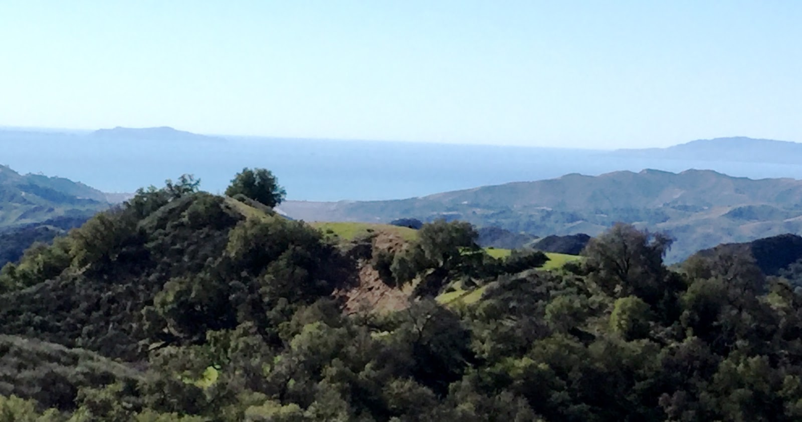
view towards the ocean and Ventura, with two islands sticking out ( I think they are Anacapa and Santa Cruz)

The hills were green and that made it so much more attractive than later in the year. I went up there once before, many years ago, and didn't like it then because on its own it isn't an interesting ride. Gentle climb, a bit over 2000 feet with a fairly steady 5-7 percent gradient.

Sulphur mountain climb

The descent back into the valley is paved and fast. There is a store at the  intersection of highway 150 and Sisar road. Kathy and I did a short night hike last year up Sisar, but that was all I've seen of it (so not much in the dark). The beginning is shady and the surface is a bit more broken up than a typical dirt road, but it becomes a wide dirt road before too long. Most hikers are around the first part and after about half an hour, I didn't see anybody all afternoon, despite it being a Saturday with very nice weather.


bottom of Sisar road


but most of the climb is more like this
 It is a long climb, about 3500 feet until the road goes around Big Chief Mountain at about 5000 feet (the top of that mountain is still a few hundred feet higher). Not particularly steep, mostly around 10% I would guess, but noticeably steeper than Sulphur Mountain. The climb is almost all fully exposed to the sun, it was hot even this time of year. At the top, there were a few snow patches on the north side in the shade, so the air temperature was still cool.


Lunch break at Big Chief mountain (2.30 by now)

That was largely it for the aerobic part of the day,  a bit meandering on the top of the ridge and then trending downhill.  I had all those mountains to myself. No other people in sight, no noise, no barking dogs, just open mountains. I stopped a few times just to enjoy that.
Taking Gridley trail down would avoid one more climb, but I continued and while the third real climb of the day to Nordhoff Peak is actually tiny (not even 1000 feet), it is the steepest and you feel it after the previous two long climbs. Shortly after Nordhoff Peak, there is a sharp 180 degree turn onto single track. I would have missed that without GPS.
Single track descent


Finally, near the bottom, the very end is some more technical single track that gets out on Highway 33. Very fun, but something to do in daylight as it has big rocks and drops. It was about getting close to 5 and there were a few hikers on that trail, first time I saw anybody else after the the bottom of Sisar. Then a quick road ride back to Ojai and I was back at the car before it got dark.