About Me

My photo
Santa Monica, California, United States

Saturday, July 4, 2020

Years 6 of the Tour de Los Padres Bikepacking Route


Boulder Canyon Trail is HARD work going up
Boulder Canyon Trail is a hard climb from Ozena!

The Tour de Los Padres, a multi-day bikepacking route in Southern California scouted by Erin Carroll has moved from being a newcomer to an established event. 2020 is its 6th year! I wrote up reports for the first two years, but not since. 2014 TDLP report  2015 Second TDLP
Until this year, it was a point-to-point bikepacking route from Frazier Park to Santa Barbara mostly through the Los Padres National forest (with excursion into the Carrizo Plain and the Temblor Range). For 2020, Erin created a 400+ km loop. Los Padres 2020 loop  

Covid-19 ended any plans for a group event or grand depart for 2020. In fact, during the most promising time, the "shelter in place" order discouraged any travel that would require going to stores. However, backcountry trails and camps were open and Obin and I went for an overnighter to check out the new route parts in clockwise direction from Frazier Park to Santa Barbara. 

New Trails for 2020

There was still a lot of snow in April and we did not go to the top of Mt Pinos (in any event, not a new trail, but a great single track). Even the paved road to Mt Pinos was closed at the bottom. 

Instead, we took the horse trail, connected with Lockwood Valley road, and then onto the dirt roads/trail that were new to us. The nice surprise was that the gates to the dirt roads were locked, no motorized traffic. That presumably was still the winter closure (there were no Covid signs or alerts anywhere in that area). In any event, the time of year to do this stretch is before it is opened to ATVs, which is probably May 1. 

Lockwood Creek
Lockwood creek, shortly afterwards starts a very steep rocky climb, the Miller Jeep Trail

Overall a fairly rocky stretch with very steep ups and downs and we took a break at the top. This whole section is open to motos at other times of the year, so not smooth single track but rough jeep trail.  

I liked the second half a lot, the Yellowjacket Trail. It is a surprise, looks like there is no way out without substantial climbing, but then there is a hidden way. Also plenty of water around here at this time of year even though this has the feeling of a dry section otherwise. Still slow going, but it isn't long before we get spit out onto Lockwood Valley road and that is a long pavement stretch, up to Ozena Fire Station. At the fire station, we get off onto real hiking-type single track, the Boulder Canyon Trail. It starts nice, but becomes a very tough push. Unfortunately, we also managed to start this in the afternoon on a fairly warm day. 
Up Boulder Canyon Trail


Break time, which is needed as this climb takes several hours! I suspect it is the single hardest climb on the route in the clockwise direction. Even though it looks green, water is getting sparse. Very different from the previous stretch, which looks dry and yet has water everywhere. There is water at the bottom in the creek, but then it gets sparse. There is supposedly McGuire spring part way up and not far from the trail, but friends who went hiking a few weeks later said it was terrible (we didn't look for it ourselves). 

The top had snow, but no water. This connects to Reyes Peak and there is a road. The car parking campgrounds were closed, here because of Covid rather than seasonal closure. It was getting dark and very windy. And after a hot afternoon, now we were cold! We dropped down a bit to Chorro Springs, which was more sheltered and also had water. No longer flowing, just a pool, but the water was still fine. Certainly good enough for the night.
Camping at Chorro Grande

But we rolled down the Chorro Grande trail early in the morning to have breakfast at Oak, which has better water - a nice running creek. 
Chorro Grande trail early in the morning

Chorro Grande Trail

Chorro Grande ends on Highway 33. We saw some cars parked there, but only one hiker near the road. Otherwise, we hadn't seen anybody since leaving pavement the previous afternoon. While this is a long stretch on a road, it also goes very fast this direction (presumably a little bit slower the other direction, but it wouldn't be much of a climb) and it was pretty in the morning and almost traffic-free. 

Near Rose Valley, the climbing starts again. Not easy, but nothing like Boulder Canyon. 

Eventually, we are up on Nordhoff Ridge and then comes the spectacular descent into Ojai, mostly Gridley Trail


The afternoon got somewhat frustrating. It was an unusually hot day, somehow we had picked about the hottest day in April and in one of the hottest sections of the route. Just getting around Ojai (we didn't go into the town, but stayed around the trails around it) was tough - and I also managed to bend my derailleur. It got worse.

Our plan was to camp in the upper Santa Ynez area and the next morning do Romero to Santa Barbara and get picked there. There is a paved road to the Matilija trailhead, but as we got there, a grumpy local yelled at us, claiming this is closed to bicycles and there is no way through. Tempers were running high there (temperature and Covid?), he was also complaining about cars being parked, people in the creek. As we stood there (I also tried to straighten out my derailleur), two sheriff cars arrived. They waved friendly at us, apparently these two cyclists weren't the problem (it might have been nude bathers?), but we decided to better get away from there and returned on pavement to get picked up in Ojai a day early. 

So not entirely successful, but still good to be out during strange times. 

Friday, July 3, 2020

Catching up on 2019 Tour de Los Padres ride report

In the Carrizo Plain 

The Tour de Los Padres route is never easy and funky weather in 2019 made a diverse route even more unusually diverse. 3 days of drying out in heat, 1 day of cold soaking. The average would have been great! But the variation less so. I got to SB around 7 pm on Monday, very cold and wet, just a day after I had been wishing for cold and wetness while counting miles for shade and water at Chokecherry. 

As in previous years, the main route was a point-to-point, starting in Frazier Park and ending in Santa Barbara and going through the Carrizo Plain. I joined the group start, or at least the shuttle to Frazier Park and the group dinner the night before. However, I don't like to stay in a motel, nor in town, so I tend to climb up the dirt road on the backside of Mt Pinos at night and camp on top. I don't roll back down to town in the morning for the group start, though, and according to Erin as a consequence declares me to "hold the record for the most course deviations over the last 6 years, while never actually having to "bail out"!  
The fast riders pass me usually around Ventucopa - as Brian Lucido and Gregg Dunham did this year. Oh, here they come already (at the Pistachio Company in Ventucopa, the green bike is mine):
No fooling around Brian, Gregg is just behind you. 
No fooling around here, Gregg. Brian already left. 

The Pistachio Company is the last reliable water for a long, long time. In fact, it wasn't until about 20 hours later that I found water again, then a rather unattractive cow trough. 

On I roll, up on Highway 33 until Erin finds a very funky way to get into the Carrizo Plain. Not the regular route (which would be annoying: longer on a busy highway, then a dirt road), no, something involving fence hopping, hike a bike, then a harder climb (but certainly worth it). I was wondering where Blake Bockius is, usually he is with the front pack. But this is a hot day, which slows down old people and Blake is almost as old as I am. Sure enough, it wasn't until the Carrizo Plain, seeminly hours later (but maybe just one) that he came by. 
Blake is still much faster than me


The Carrizo Plain is bounded by two mountain ranges, the Temblor, which is to the northeast, and the Caliente, which is to the southwest, and is cleaved by the San Andreas Fault. The fault is often photographed here because movements show up clearly. There is an exhibit along Buckhorn road, which we take. 

I was pretty wiped and camped in the Carrizo Plain well before Soda Lake. Although I've camped in here before, repeatedly, I apparently missed a key resident before. It is the home of the Giant Kangaroo Rat! Some Giant Kangaroo Rats live elsewhere, in small pockets elsewhere in the the San Joaquin valley, but mostly they are here. And I got to see many of them. They are kind of cute, nicer than regular rats, and not really that giant. But their hopping around at night (on two legs, they are like kangaroos in that respect) can get a bit unnerving. 


The next morning is usually nice. There is a fairly hard climb up into the Caliente Range, but it is always pretty. The afternoon, once the sun is at full force and the temperatures are up, are a different story. Especially once you run out of water. It is hard to find. 

The dry stretches help to appreciate the challenges travelers in the Southwest had to overcome in the past - without GPS, waypoints to water, and slower on foot or wagon than we are on bicycles. In my motorcycle blog posts in Mojave, I collected quotes from the 1850 (also a wet winter) travelers across the Mojave desert (Manly and Rogers party, the Jayhawkers) , who suffered much worse and some didn't make it. Comparing our outdoor experience with that from 150 years ago helps to appreciate how easy life is these days even when it feels hard!

"There was now before us a particularly bad stretch of the country as it would probably take us four or five days to get over it, and there was only one water hole in the entire distance. This one was quite salty, so much so that on our return trip the horses refused to drink it, and the little white one died the next day." William Lewis Manly (1894), Death Valley in '49, Ch. 11

TDLP, even with camping, never has more than 30 hours or so without reliable water - and we know where those are. 


On top of the Caliente Range in the morning - but the next sets of canyons will take all afternoon


And the afternoon never is fun. It does get hot in the Caliente Range. And there isn't much water (or at least not very attractive water) until Gifford Springs. It was strangely full, even overflowing, and I got a shower while filling up my water bottles - you can see the water splashing down on the side

No up on the other side and even though the temperatures have cooled down, the day in the sun took its toll. I found a nice campsite off Sierra Madre road, maybe halfway up the long climb. 

Day 3 was the usual, much of it along Sierra Madre road. Could be nice, but this time too hot and too dry. It reminded me of Manly's book about crossing the Mojave:

"Our thirst began to be something terrible to endure. We were so nearly worn out that we tried to eat a little meat, but the mouth would not moisten it enough so we could swallow and we had to reject it. It seemed as if we were going to die with food in our hand because we could not eat it. We talked a little and the burden of it was a fear that we could not endure the terrible thirst a while longer." William Lewis Manly (1894), Death Valley in '49, Ch. 10

Now, I didn't suffer that much. I never ran completely out of water, but it happened to Gregg I believe, who was so thirsty that he couldn't eat. 

Pretty views from Sierra Madre Road in the morning

It was another long dry day, too hot and too dry to be enjoyable. But as I reached the highest point of the day, near Big Pine Summit, there was lightning, now the goal was to get down quickly. In other years, I stopped for a hike up to the mountain top, but this was clearly not advisable this year. 

Around sunset, a thunderstorm was coming in

The next morning was very different. It was cold and damp and the surface has become so muddy that I even had to walk some downhill stretches as the tires got too clogged with mud. Fortunately, these were short stretches, but frustrating anyway. Couldn't we just get a middle between yesterday and today? 


Rocky roads cause slashed tires


This hadn't happened to me before on a trip, so maybe slashing a tire was overdue. I had spare tubes and a tire boot (the gash would have been too big without closing it up) and I got going within 15 minutes or so. But cold and unpleasant 15 minutes. 

The big dirt road was destroyed during a fire a few years ago and mustard weed have taken over. Usually, such gentle bushwhacking is fine, maybe even enjoyable. Not today: Those weeds were cold and wet and made the descent miserable. 


But eventually the descent comes to an end. There is the fun Camuesa Connector trail and then it is time to cross the Santa Ynez river. The mightiest Santa Ynez flow I've ever seen, but it still is less than knee height. 


There is one long climb left after the river, then there could be the lovely Romero single track downhill. However, my rear tire was too fragile for single track riding and I took a shortcut via Gibraltar road, which is a paved road. Less interesting, but then I had never ridden it and I've gone Romero up and down many times. But Romero is the better way! 


Tuesday, April 7, 2020

Winter Motorcycle Trip #4: Last sections of the California Backcountry Discovery Route

April 2019: Benton to Death Valley
A chilly April day, more snow falling in the Eastern Sierras

It still is an unusually cold year, late April and it feels like mid-winter (Southern California midwinter, though). In fact, my first mountain bike trip, Erin Carroll's Tour de Los Padres was pushed to the end of April because of all the snow. So it is yet to come. 


Instead, I first head off for another motorcycle trip on the new CA BDR (backcountry discovery route). The CA BDR route was released January 2019 and I got the map as soon as it was printed. I did the first 5 sections in February on a 1000 mile loop: CA Backcountry Route. Now I want to do the remaining part of the route, which is from Death Valley to Benton, mostly along the Eastern Sierra. 

Death Valley itself is now getting hot, temperatures between 35 and 40 degree celsius. Not unbearable yet, that will happen soon, but hot. Later than usual because I have been to Death Valley 3 times already this year (in January, February, and March) and was cold there every time (and got rained on)! 

Forecast was for pleasant temperatures, but sure enough, I got rained on (and only because I wasn't at altitude yet)


Section 7 of BDR: Bishop to Lone Pine - can't avoid the valley

I was going north to south and when I turned off Death Valley Road  (coming out of Big Pine) at a higher elevation, there was too much snow to get through. And no tracks ahead of me, so it looks like that: 
Papoose Flat/ Mazourka Canyon had too much snow to get through


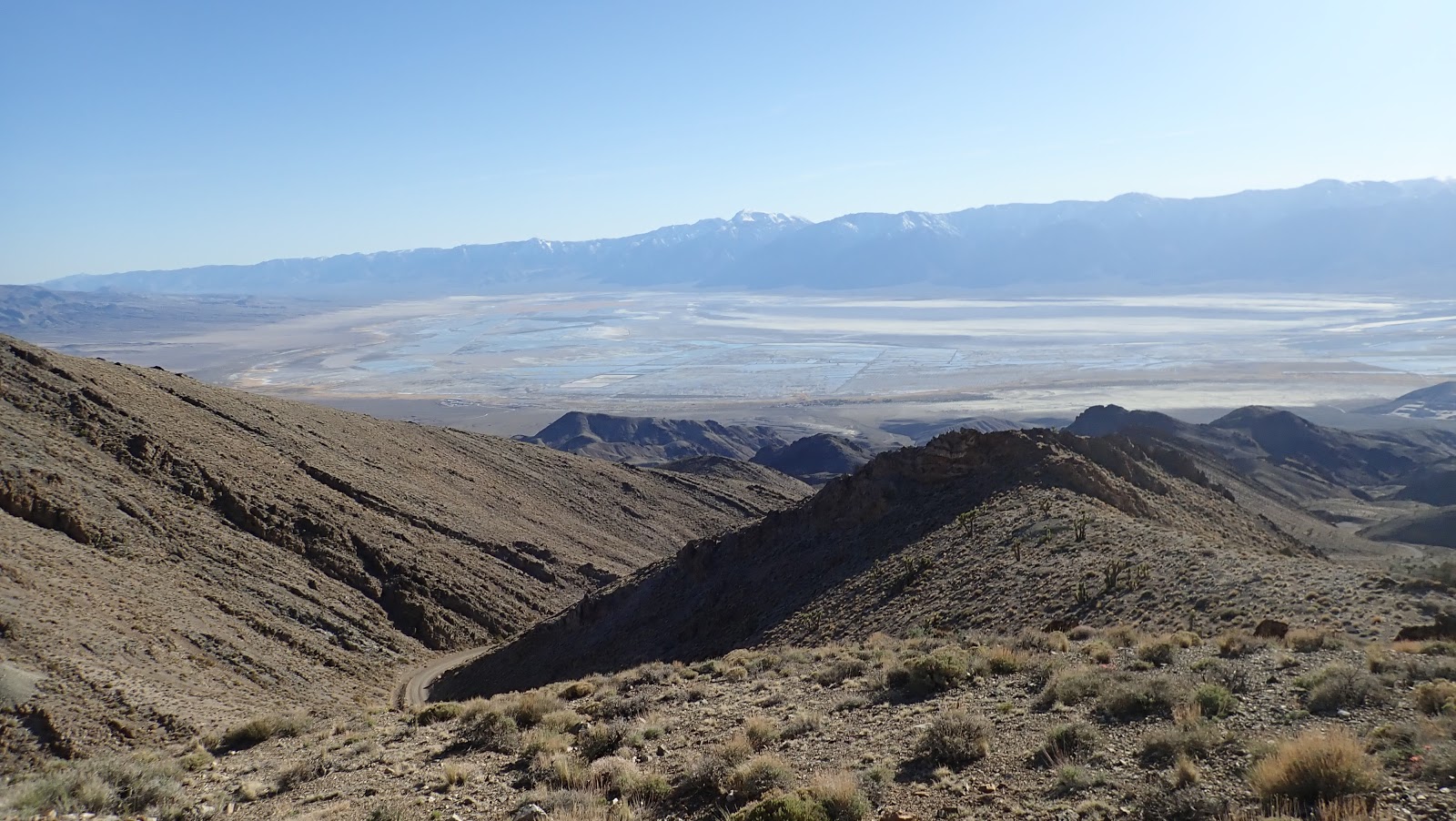
I had to turn back and took the easier valley route in the Owens River Valley. Typical for Southern California, there is very little water to be seen even in what could be the river bed. Much of the water tends to be underground and surface water only appears briefly after winter storms. Until about 100 years ago, the river drained into this valley and there was enough to be a lake between Lone Pine and Olancha. In the early 1900s, the Water Wars started when Los Angeles bought land upstream to have water rights. Beginning in 1913, the Los Angeles Aqueduct diverted enough water from the Owens River that the river bed and former lake dried out. 


In the Owens River valley, since 1913 mostly dry as the water goes to Los Angeles


Somewhat boring, mostly just a wide dirt road that parallels Highway 395. Might as well just stay on pavement (the only reason not to do that is that the XT225 can't keep up with the very fast traffic). There was a small detour to the Reward Mine, which was a bit interesting. The trail to the Reward Mine is quite steep and rocky. It is possible to ride into the mine for a bit, but I didn't. 

The old Owens river and lake bed in the valley are dry


The route crosses the highway at the Manzanar Historic site, one of ten concentration camps where Japanese-American citizens or resident Japanese were interned during the Second World War. The brief next stretch is nice, connecting back to Lone Pine via the Whitney Portal Road. 


Alabama Hills 

I camped in the Alabama Hills. Nice rock formation at the bottom of the big mountains. Although weather was getting gloomy and it seems remote, lots of campers out there. 


 Section 6 of BDR: Lone Pine to the Death Valley "Racetrack"

The idea was to ride up to the Cerro Gordo Mine/Ghost Town, down Saline Valley, up Lippincot. It is a long dirt road up to Cerro Gordo


 Cerro Gordo was sold recently to a group of people who want to redevelop it as a tourist attraction. From what I gather, the primary owner is a young guy from Texas who plans to move up here and work on it himself. 

As soon as I stopped, a caretaker came out to check on what I'm doing (and reminding me that this is private property and can't go anywhere here). So in transition, not clear what will happen to it. 


In 2020, there was a fire at Cerro Gordo and some of the biggest buildings are gone by now (the old hotel). 

Past Cerro Gordo, the descent becomes quite rocky and challenging. More technical, very different from the dirt road that goes up to Cerro Gordo. Once at the bottom,  I found it confusing and couldn't immediately find the trail, which should be the White Mountain Talc road. According to the map, not difficult riding (whereas coming down Cerro Gordo was marked as "experts only"). Eventually I found one, although it seemed quite rocky and not exactly an easy ride. But not boring, so I took it and it was fun riding. Somehow, though, it didn't seem right. And after a while, I had the feeling that I've been here before. Then the feeling got stronger and I found myself at Cerro Gordo again!

OK, that was a sign to go back to pavement and start heading home. Lippingcott and Racetrack have to wait for another time.